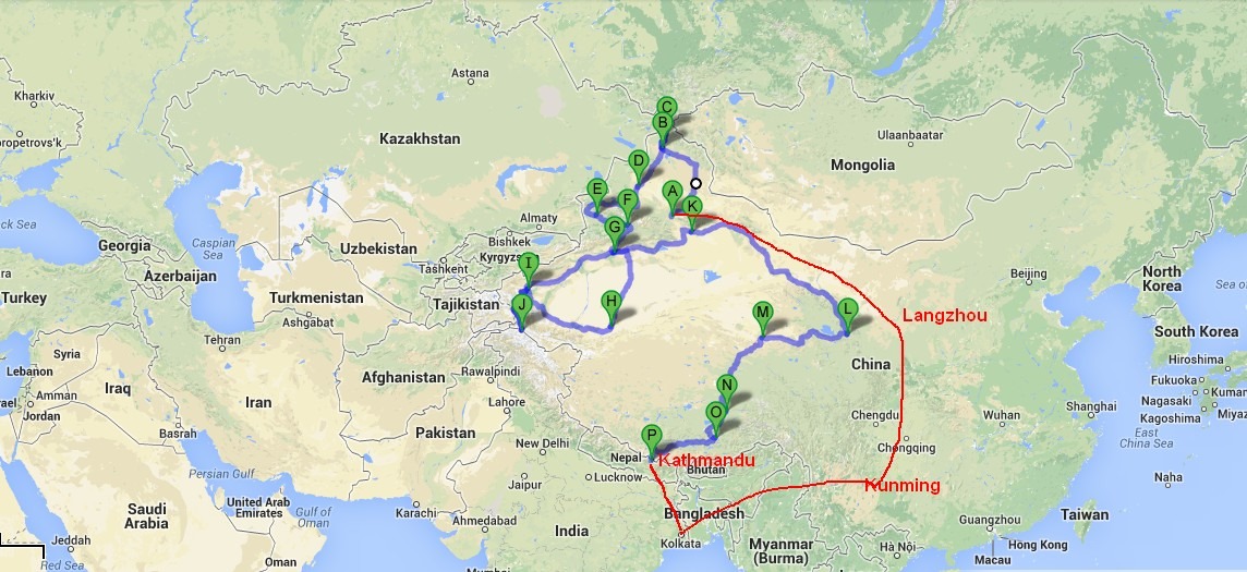
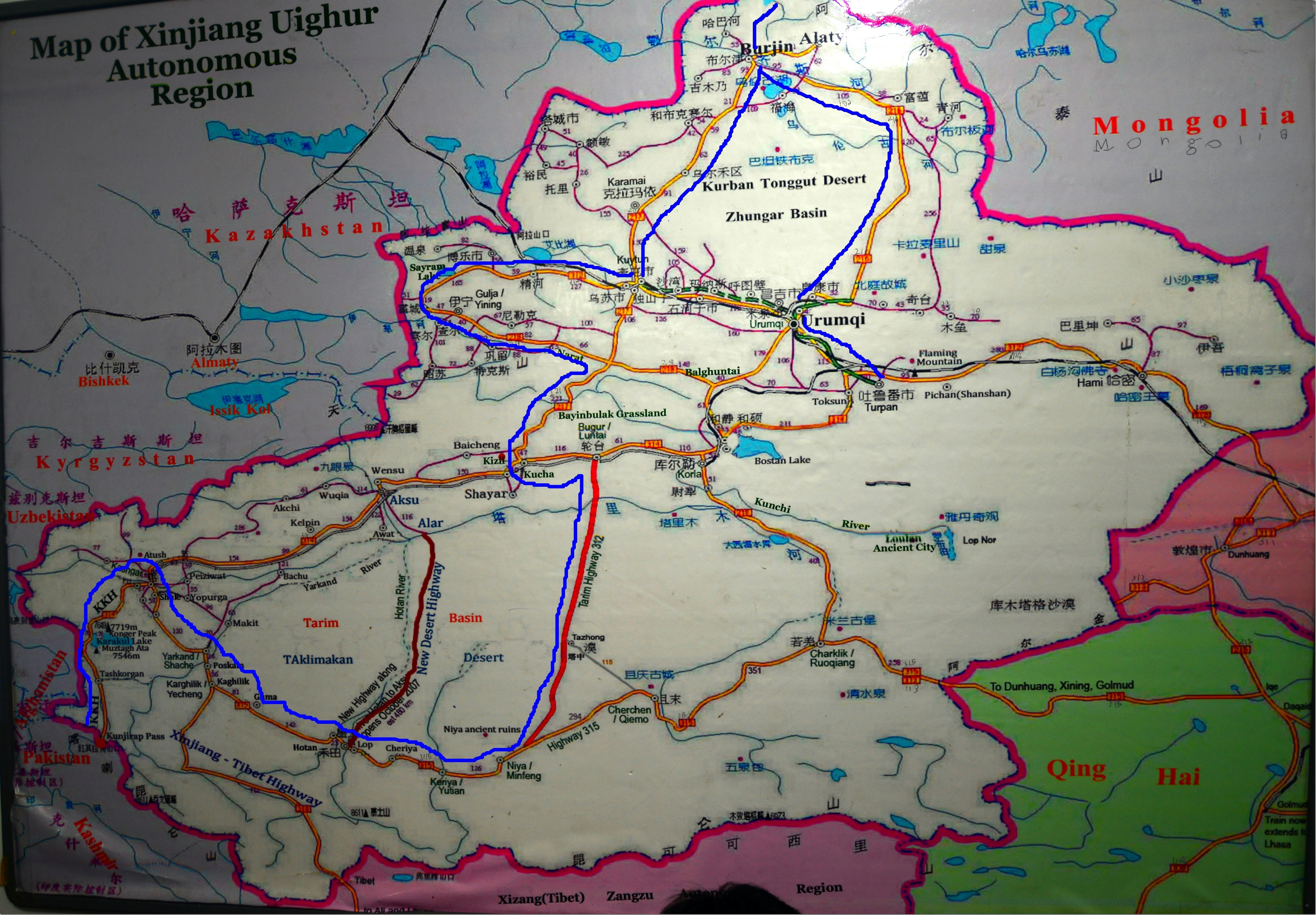
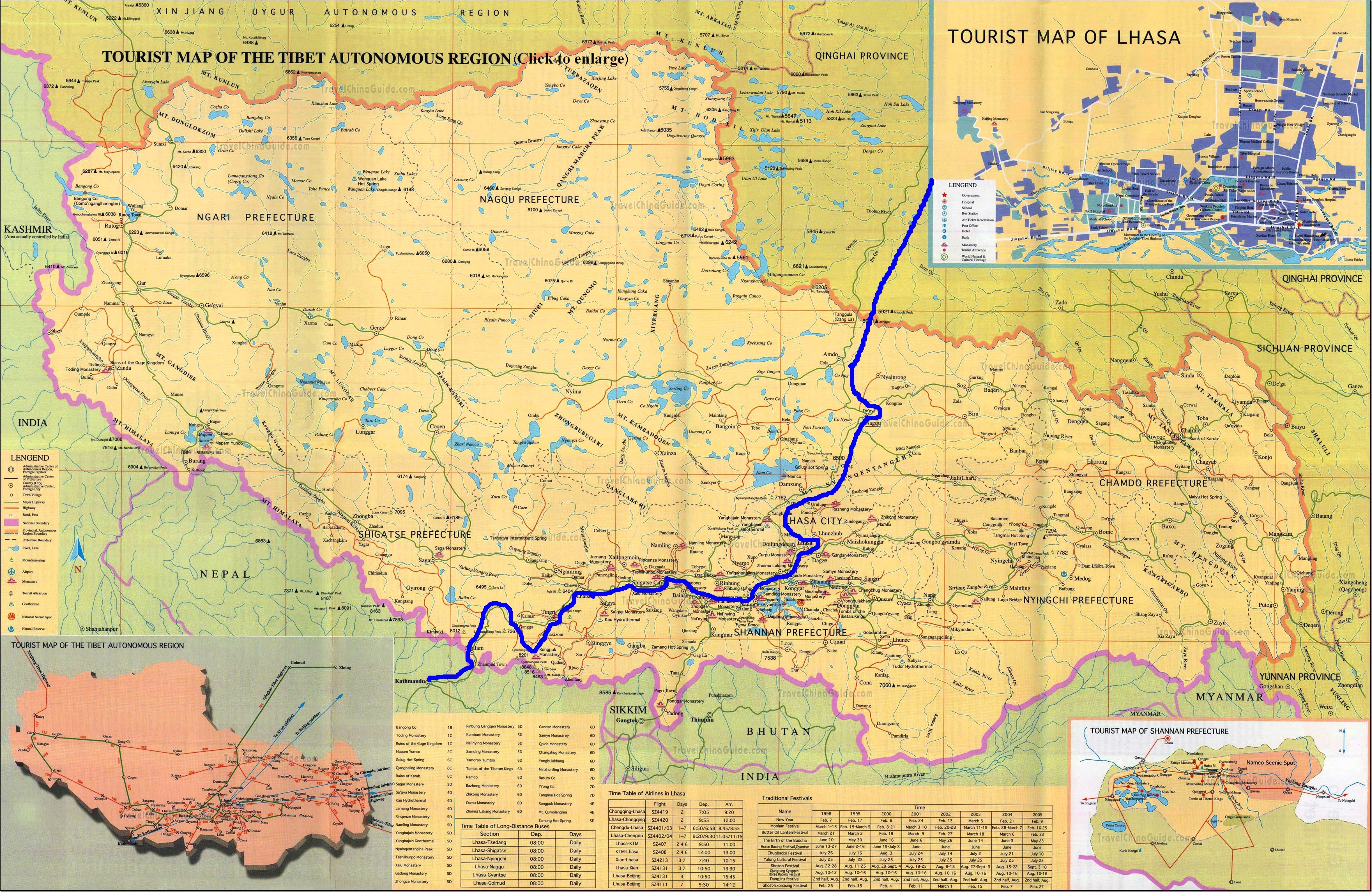
Well, before going to detail planning, let me try to give an idea of the route map, it was so long a trip and we touched upon so many places, you might feel lost unless I show it in a map. It’s actually too big to be shown in a map, still trying with 3 snaps, first one on whole route map at a glance and next two are detail maps of Xinjiang and Tibet. This is the best Xinjiang map I ever seen in a travel agent’s office and took a snap of it, Tibet map I found in net, can’t recall from which site I downloaded it. But both are pretty accurate.
Overview of the route:
We flown from Kolkata to Kunming (which is around 2 hours flying) before changing flight there to Urumqi (Pronounce most q as ‘ch’ there, so it’s more like Urumchi), which is capital of Xinjiang Uighur Autonomous Region (XUAR), the largest province of China, totaling 1/6th of whole China’s land mass. The flight between Kunming to Urumqi takes 5 hours (Close to East-West Coast Flying time of US). The flight route was bypassing Tibet Plateau, rather going north to fly between Chengdu and Chongging and then go up to Langzhou in North and then taking a West turn to cross the Gobi desert just south of Mongolia – China Border to reach finally Urumqi.
The Road journey starts from Urumqi.
Day 1 – Kolkata – Kunming – Urumqi (Flight)
By Road:
Day 2 – Urumqi – Burqin (Pronounce as Burzin), our one of the longest drive 750km drive through Jungaar Basin (A part of Gobi Desert) to Northern Altai Region, Burqin is gateway of Altai Prefecture. We saw multi colored Bay on the way. (A-B)
Day 3 – Short drive of 150km from Burqin to Jiadengyu which is gateway of Kanas Nature Park and explore the park, this is extremely close to border of Mongolia, Russia and Kazakhstan with China and the climate is just like Southern Siberian Tundra, in Sep, we were experiencing -15 degree C at night here. (B-C)
Day 4 – Full day explore the Kanas Park
Day 5 – Jiadengyu – Back to Burqin – Karamay, a drive of 400 km. Karamay is the oil city of China, you can see natural oil spring here. This is the place where you see the amazing landscapes created by Air Erosion called Ghost City (Chinese are very imaginative and they name almost everything to Ghost or Dragon, you will find hundreds of Ghost Cities and Dragon Bays in China) (C-B-D)
Day 6 – Karamay – Sayram Lake – 300km drive (D-E)
Day 7 – Sayram Lake – Nalati Grassland – 400km drive (E-F)
Day 8 – Nalati – Kuqa (Pronounce Kucha) – 500km drive (F-G)
Day 9- Kuqa Around
Day 10 – Kuqa – Niya (Minfeng) – 750km, crossing World’s longest Desert Highway to South Silk Route’s first Oasis (G-H)
Day 11- Niya – Hotan – 200km (Hotan is somewhere between H and I, not showing here)
Day 12 – Hotan – Kashgar – 550km (To Point I)
Day 13 – Kashgar – Karakul Lake / Tashkurgan on Karakoram Highway (Somewhere between I and J) – 300km
Day 14 – Tashkurgan – Kunjerab Pass till border of Pakistan and back to Tashkurgan on Karakoram Highway – 250km (Kunjerab Pass is Point J)
Day 15- Tashkurgan – Kashgar Back – 300km
Day 16- Kashgar Around
Day 17 – Fly Back to Urumqi (I to A)
Day 18 – Drive from Urumqi to Turpan (A to K) and back to Urumqi – Total drive of 450km
Day 19 – Fly from Urumqi to Xining (A to L)
Start of Tibet Leg
Day 20 – From Xining (L) catch the Mountain Train to Lhasa (O) via Golmud (M) and Nag qu (N), Total journey of 2000km
Day 21 – Reach Lhasa (N)
Day 22 – Explore Lhasa
Day 23 – Lhasa – Nam Tso – Lhasa (We skipped this later as my daughter was not well, instead we explore Lhasa more)
Day 24 – Lhasa – Shegatse (Taking the Friendship Highway) Drive of 350km
Day 25 – Shegatse – Shegar, 300km Drive
Day 26 – Shegar – Everest North Base Camp at Rongbuk (Drive of 100km) (We couldn’t finally made it because of super cyclone Philine, which blocked road for more than 72 hours)
Day 27 – Rongbuk – Drum (Jhangmu) 300 km drive
Day 28 – Drum clear Chinese Immigration and proceed to Kathmandu (Nepal) (P) Drive of 130km
Day 29 – Kathmandu – Kolkata Flight back home
Total overland distance traveled around 10000km
Xinjiang Map (See the Blue Lines and above description to understand the route.) :
Tibet Map (See the Blue Lines and above description to understand the route.):
Overland travel from Kashgar to Lhasa, which would offer an alternative to backtracking to Golmud:
This epic highway 219 that starts from Karghilik (Yecheng in Chinese), a town between Yarkhand and Hotan, crosses more than ten 5000 meters pass with average altitude of 4000 meters is considered as deadliest and loneliest highway in planet earth. The highway ends at Lhatse when it meets with Highway 315 between Shanghai and Kathmandu via Lhasa more often known as Friendship Highway.
The Highway 219 is now completely paved and the road work was completed just in 2012 and after forking it from Yecheng, it goes up to cross Kunlun and part of Karakoram ranges through Mazar (From where the Mt. K2 North Base Camp Trek starts, you might be knowing the K2 North side climb starts from Xinjiang, China) and Dongluitan (which is just a trucker stop) and then crosses Aksai Chin which is a flat salt basin (which is considered disputed between India and China and led to 1962 war when India discovered about Chinese built up highway 219 through this in 1960-61 period) to reach Tibet and first Tibetan town Dorma is again a trucker’s stop. Then it crosses through amazing Pangong Lake at Rutog before entering the capital of Ngari prefecture of Tibet at Ali (Named as Senge Kabab in Tibetan). The road goes further down south and then turned East and passes through Mt. Kailash and Mansarovar region which is considered holiest place in Hindu and Buddhist religion. After Mansarovar the road goes further 450km east to reach last prominent town of Ngari, named Saga and from here the road is forked in 3 different direction. The right turn towards south will take you to Zhangmu, Tibet-Nepal border and further to Kathmandu. The Left will take you to remote Changthang in North crossing Tsochen and further crossing Gertse and Geggye to meet in Ali again. The main road goes further East and meet Highway 315 in Lhatse and ends there.
My original travel plan was , after Kahsgar, I was about to take Yecheng – Dongluitan – Dorma – Rutog – Ali – Tsada – Darchen – Saga – (fork right) – Zhangmu – Kathmandu and Lhasa was never in my plan in this trip.
The major problem of taking this route from Kashgar to Lhasa direction was
1. The altitude jump between Yecheng (1200 meter) to Dongluitan (5200 meter) is proved to be fatal in one night as there is no place to stay in between. AMS can be triggered severely and in that remote region can be fatal.
2. Getting all necessary permits for Tibet is a big ask to arrange from Kashgar end and you need more logistics support of getting all done in Lhasa and then couriered to you in Kashgar, which is costly and prone to chance factor. Of course the cost will be high.
To go through this road one need
a. Tibet Permit
b. Alien Permit
c. Sensitive border permit
d. Army Permit
e. Permit from Foreign Affairs Ministry
3. Foreigners are not allowed to use local transport in Tibet and you need to hire private transport and guide for Tibet. For this leg, it’s extremely difficult to get this from Kashgar end and most likely you need to hire a Lhasa based agency for this logistics support and the cost is extremely high.
It’s easier to arrange this trip from reverse direction if you start from Lhasa and end up in Kashgar but ready to pay huge premium for this journey if you take it from Lhasa. Usually many foreign tourist adopt a trick of hitchhiking the stretch between Yecheng and Ali in some trucks and then when caught in Ali without permit, they pay the fine and the Chinese send them to Kathmandu border or towards Lhasa. That’s easiest way to do this section but if you are unlucky you may be deported back to Yecheng again. With family this was not possible for me and also now a days police monitors every truck and catch anyone who tries to sneak in without permit.
Now for Indians this stretch between Yecheng to Ali (read crossing Aksai Chin) is absolutely off limit. I got 4 permits and spoke to their external affairs ministry and they said I could take the rest of the trip except between Yecheng and Ali overland. My only option then was to take a flight from Kashgar to Ali which was very overpriced and only a weekly connection and the biggest risk was I needed to get all permits in place to board the flight. Also that way I couldn’t take the overland between Kashgar to Kathmandu as planned, so I finally dropped it.
To cut long story short, if you are in Non-Indian Passport and take this trip from Lhasa to Kashgar direction and ready to spend a fortune, you can experience this amazing road.
Now some snaps.
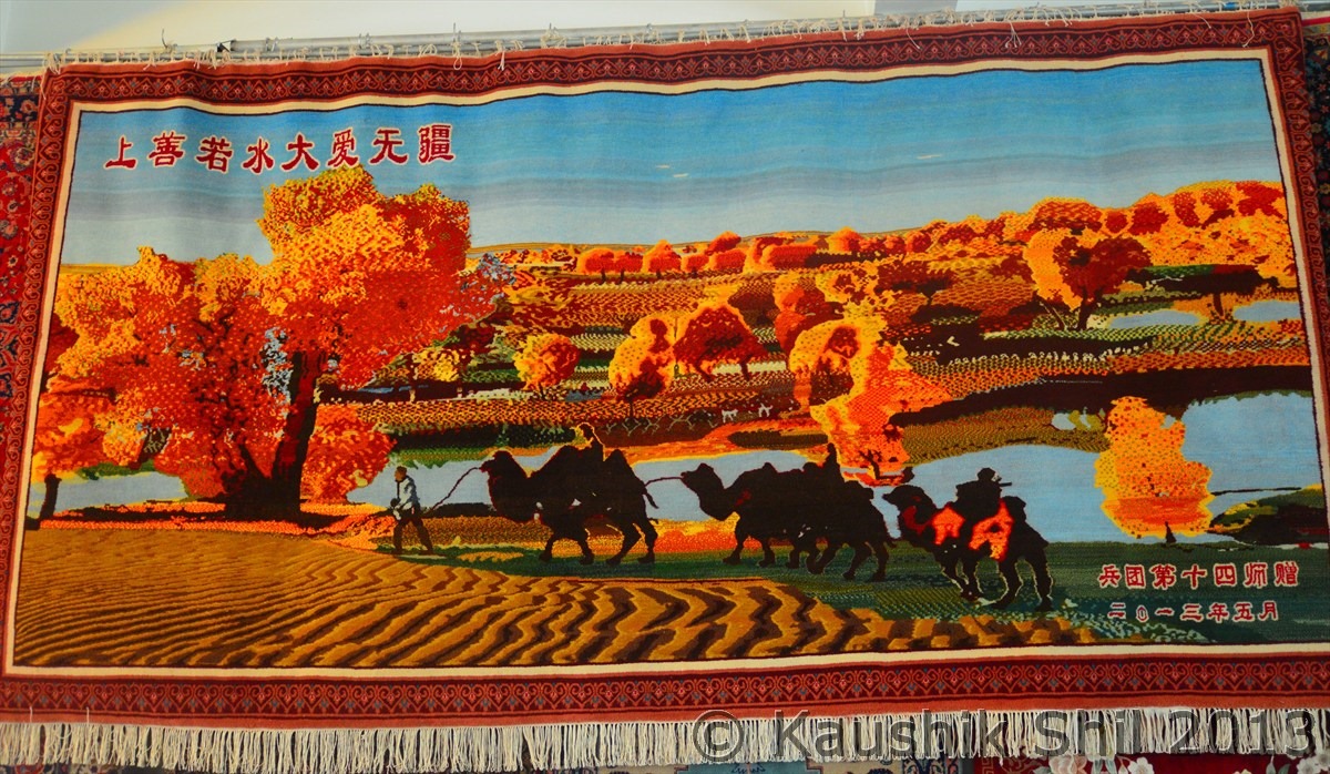
This Carpet needed 5 crafted women worked for 4 months:
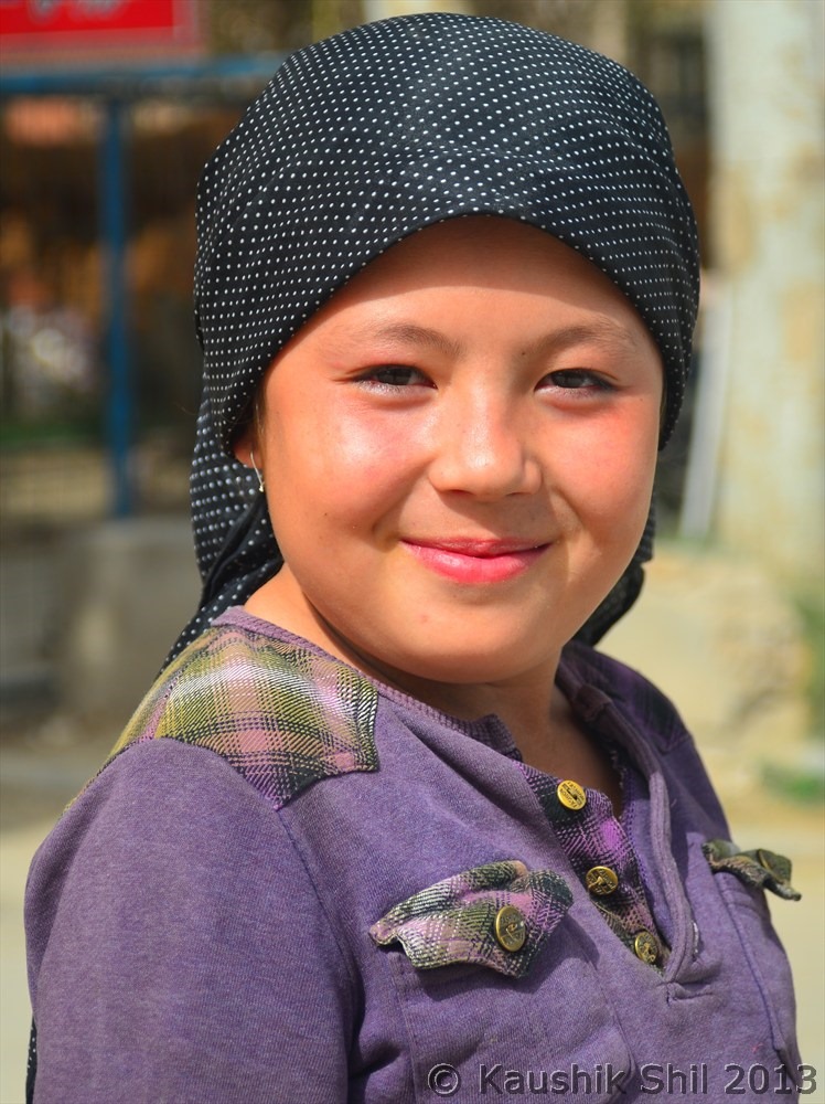
One young Uighur Carpet Maker, they retain it generation wise:
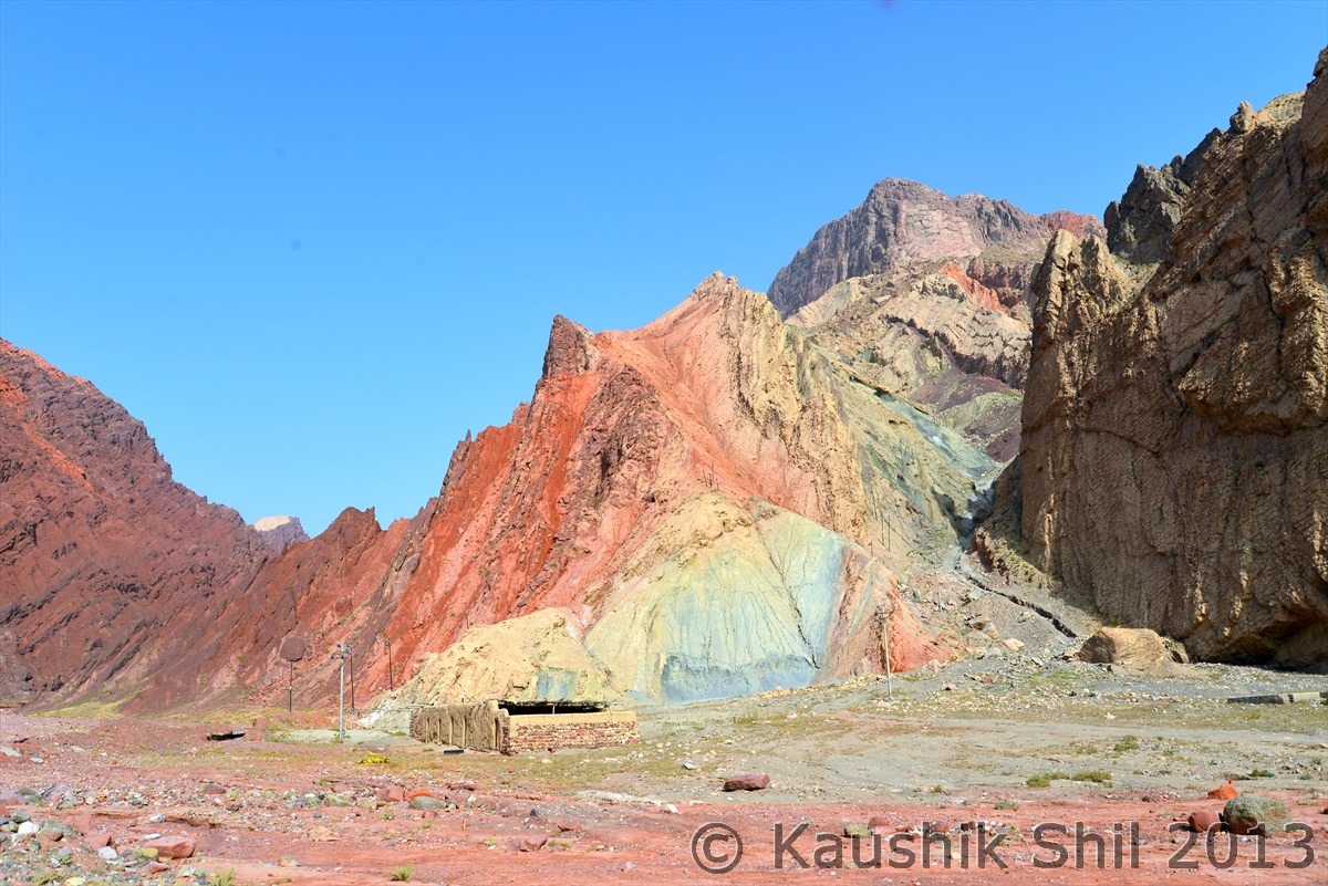
Natures own painting:
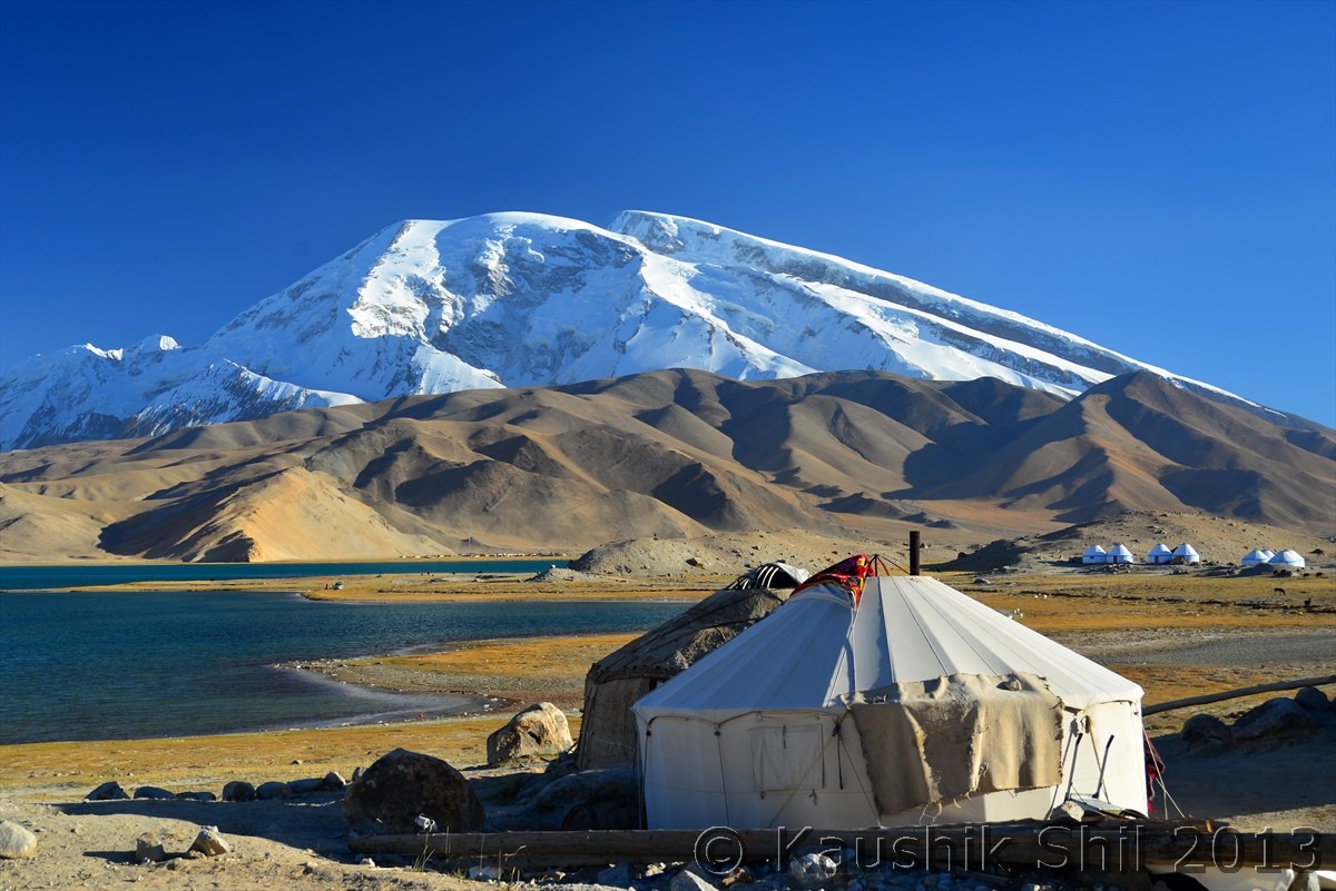
Muztag Ata – 7750 mtr high peak in Kunlun range in the backdrop of Karakul Lake with Kyrghiz Yurts, you will love to stay:
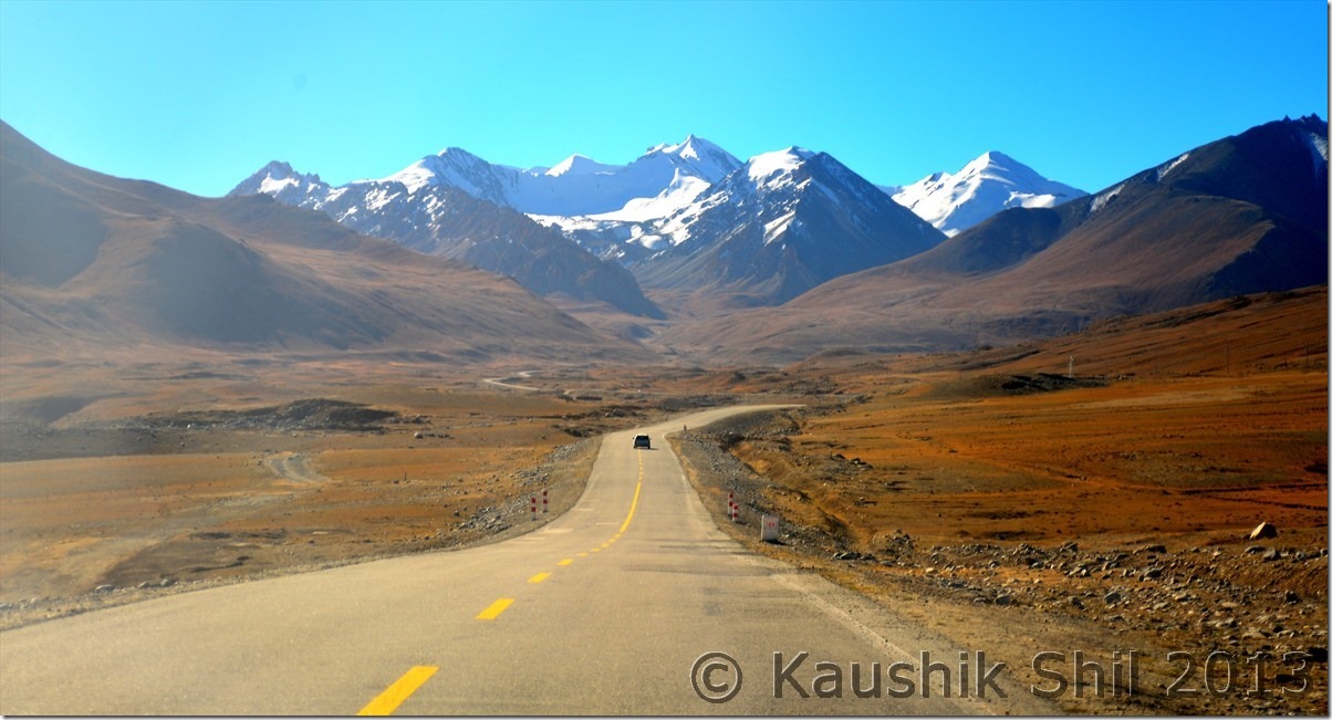
Driving on famous Karakoram Highway, 1500km engineering marvel connecting Kashgar in China to Islamabad in Pakistan across high Pamir and Karakoram Range
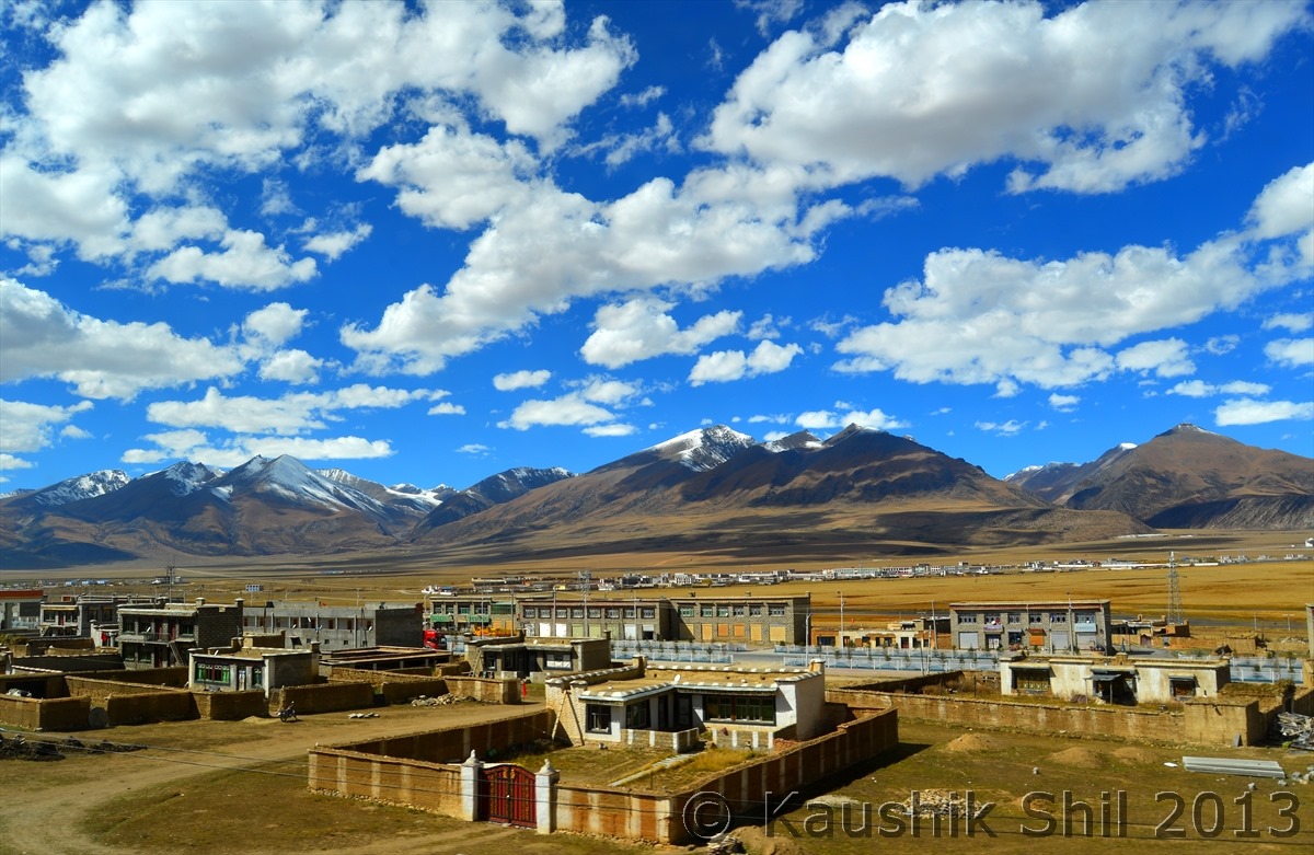
A small town on the way:
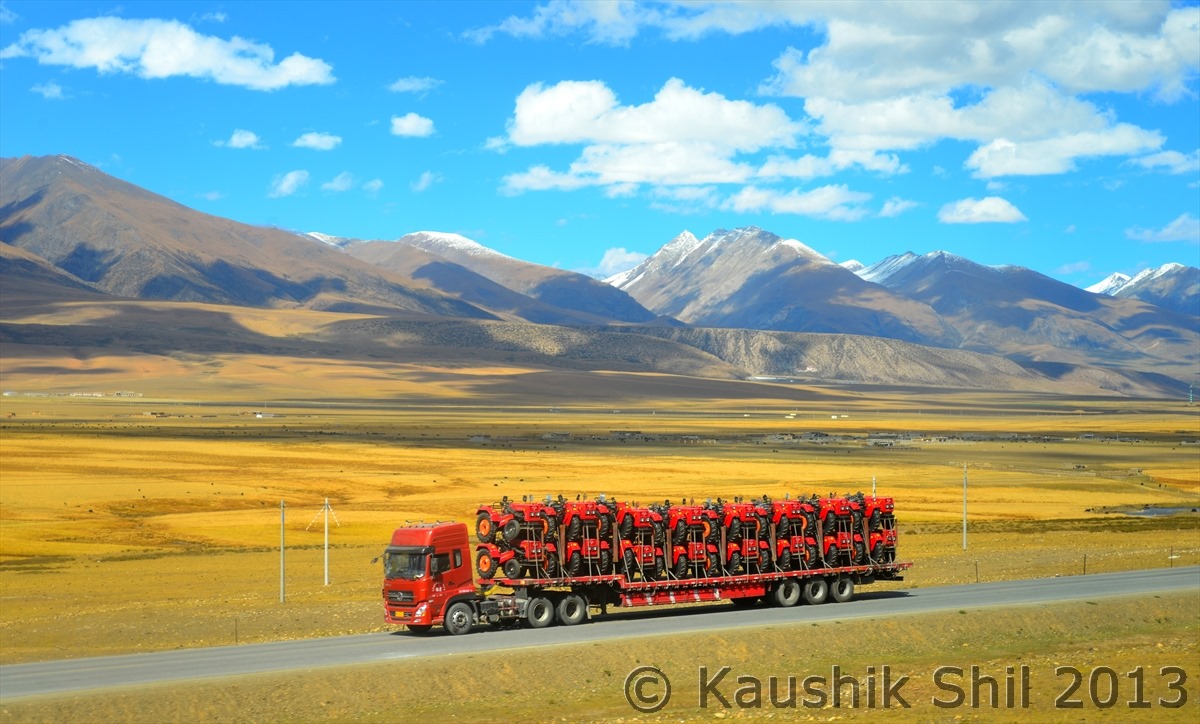
A truck in rugged terrain:
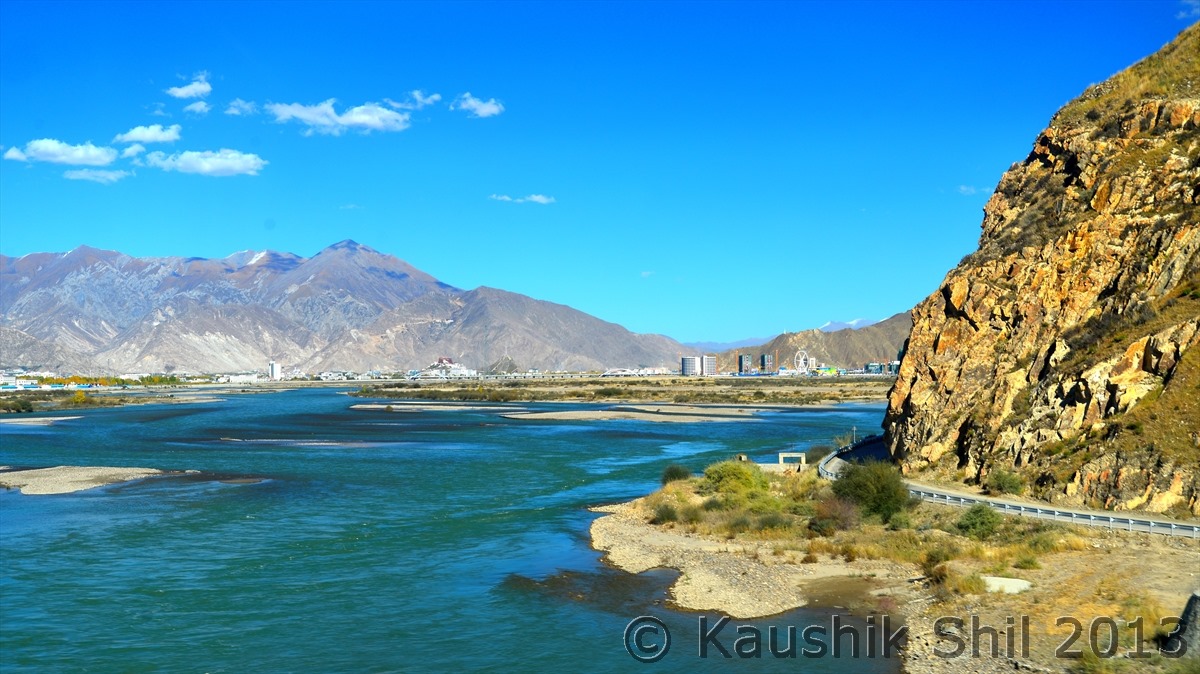
Lhasa River:
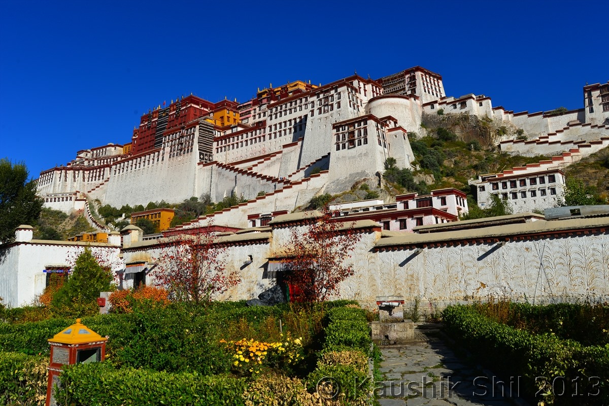
Potala Palace – Residence of Dalai Lama until mid of last Century when 14th Dalai Lama Fled to India after Chinese Aggression : Another dream accomplished
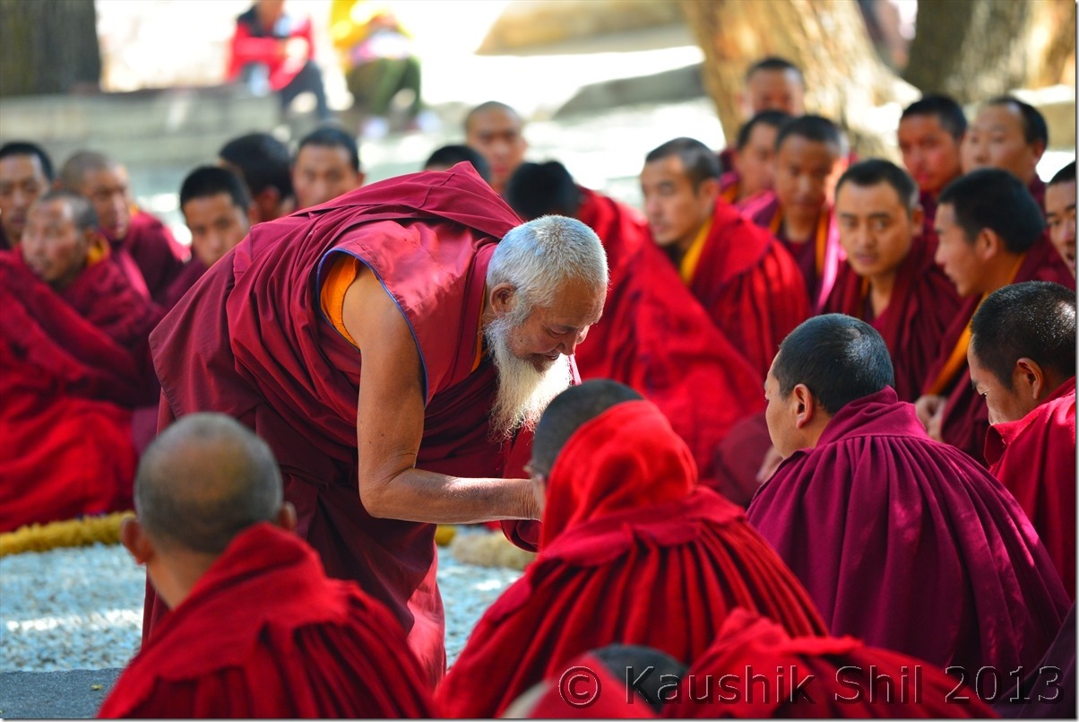
Authentic Tibetan debates on Buddhism still taken place in Sera Monastery of course under supervision and closely guarded:
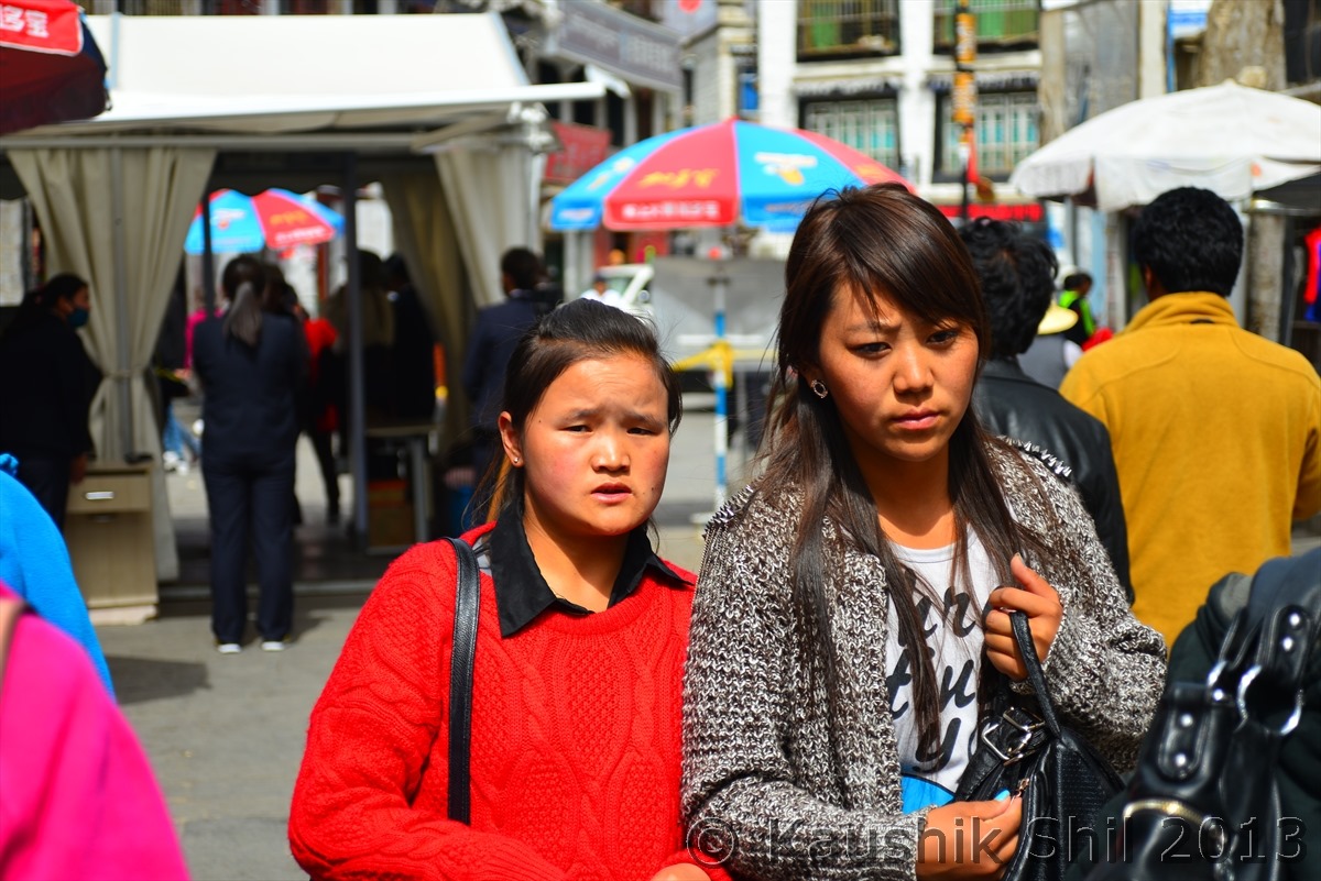
Unintentionally I took this snap, trying to take street photo, see the anxious Tibetan faces, anxiety in all corner, note the background, those black dressed are police and that’s one of the many X Ray Scanning machines in most part of old Lhasa. Every 100 mtr your hand bag will be scanned and you will be searched. Normally photography is strictly prohibited in these searching places and they can snatch your camera if they find you shoot this. Tibet is now like a closed cage, worries are evident even in these young faces.
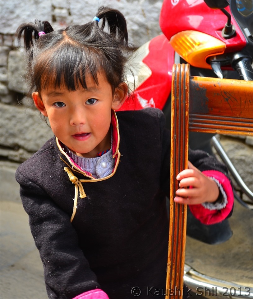
This cutie has played a long hide and seek game with me before I could catch a snap:
Previous: Prologue
One thought on “Xinjiang, China’s Central Asia and incredible Tibet–Route Overview”
Comments are closed.